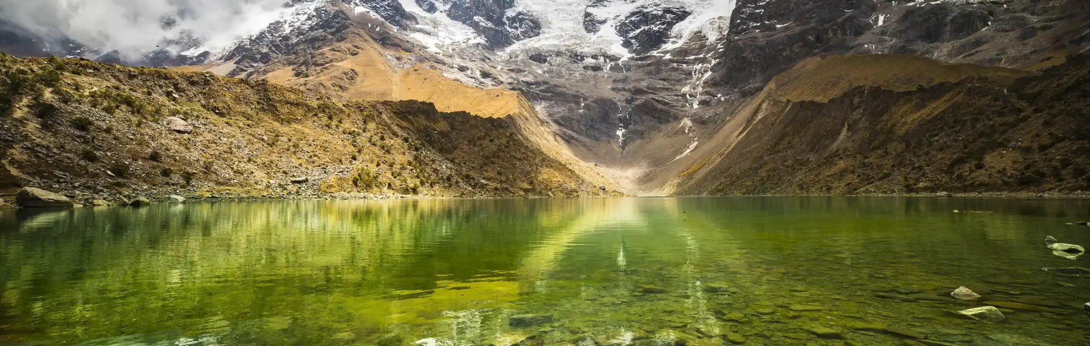

Weather represents one of the most immediate and consequential variables affecting the Salkantay Trek experience. Yet most trekking guides reduce weather to simple bromides: “bring rain gear” and “expect afternoon clouds.” This superficial treatment overlooks the sophisticated meteorological systems governing Salkantay’s weather, systems that, when understood, become predictable and manageable.
Mountain meteorology differs fundamentally from lowland weather. At 4,650 meters elevation, atmospheric physics operates under different constraints, creating distinctive weather patterns absent in flatter terrain. Temperature gradients steepen. Wind acceleration becomes extreme. Moisture processes operate differently. Cloud formation follows different triggers.
This comprehensive guide explores the meteorological principles governing the Salkantay region, explaining not just what weather to expect, but why these patterns emerge, how to recognize and predict them, and how to make informed decisions based on meteorological understanding.
Mountain weather begins with fundamental physics. The atmosphere decreases in density exponentially with altitude, meaning half of Earth’s atmosphere lies below 5,500 meters elevation. At the Salkantay Pass (4,650 meters), approximately 46% of atmospheric mass lies above you.
This density decrease creates several critical consequences:
Reduced Pressure: Atmospheric pressure decreases following the barometric formula: pressure roughly halves for every 5,500 meters of elevation gain. At the Salkantay Pass, atmospheric pressure measures approximately 440 millibars (0.44 times sea level pressure).
Altered Thermodynamics: The relationship between temperature, pressure, and density follows the ideal gas law. At lower pressures, air parcels expand more readily when heated or forced upward over mountains.
Changed Energy Distribution: The atmosphere’s energy (and thus weather formation potential) exists in this reduced mass. While the energy density per unit mass remains similar, the total energy available for weather processes becomes more concentrated.
The most profound meteorological principle governing the Salkantay region involves orographic forcing—how mountains physically force air upward, triggering precipitation and creating distinctive wind patterns.
Prevailing winds in the Southern Hemisphere’s mid-latitudes flow from west to east (westerly flow). The Andes present an insurmountable barrier to this flow. As moisture-laden air encounters the mountain, it’s forced upward. This ascent cools the air, triggering condensation and precipitation.
The windward slope (western Andes) receives dramatically more precipitation than the leeward slope (eastern Andes). The Salkantay region, positioned on the steep western Andean escarpment, experiences this intense windward precipitation pattern.
As air descends the eastern (leeward) slopes, it warms adiabatically (warming from decompression rather than heat absorption), becoming drier. This descending air creates rain-shadow effects—notably dry regions on the leeward side of mountains.
When air is forced upward over mountains, it undergoes adiabatic cooling—cooling caused by expansion of the air parcel at lower pressure. The rate of adiabatic cooling depends on moisture content:
Dry Adiabatic Lapse Rate (DALR): Unsaturated air cools at approximately 9.8°C per kilometer of elevation gain (technically 0.98°C per 100 meters). This rate depends only on gravitational acceleration and is nearly constant regardless of location.
Moist Adiabatic Lapse Rate (MALR): Saturated air cools more slowly—approximately 6.5°C per kilometer on average, though this rate varies with temperature and moisture content. This slower cooling occurs because condensation releases latent heat, partially offsetting the adiabatic cooling.
Practical Implication: Air becomes saturated and clouds form where the cooling rate brings temperature to the dew point. On the Salkantay’s windward slopes, this occurs predictably—typically around 3,000-3,400 meters during normal conditions, explaining why sustained cloud cover dominates higher elevations.
The difference between DALR and MALR creates conditional instability—a state where air becomes increasingly unstable (likely to rise and produce convection) as it becomes saturated. This instability explains why afternoon thunderstorms become more likely as the day progresses and surface heating increases moisture content.
Contrary to the perception that mountain weather is chaotic, the Salkantay region exhibits remarkably consistent daily weather patterns, particularly during the dry season.
During the dry season (May-September), predictable daily cycles emerge:
Early Morning (5:00-8:00 AM): Clear skies and excellent visibility are typical. Overnight radiative cooling (heat loss to space through infrared radiation) has chilled the surface, creating inversions where temperature increases with altitude in the lowest atmosphere. These stable conditions suppress cloud formation.
Humidity remains high from overnight condensation, but visible clouds haven’t yet formed. This represents the optimal window for visibility and photography. Experienced trekkers begin hiking early to capitalize on these clear conditions.
Late Morning (8:00 AM-12:00 PM): Solar heating of the ground initiates convection. The surface warms, heating overlying air, creating buoyancy and upward motion. Cumulus clouds begin forming around 3,000-3,200 meters as air parcels rise and cool to their condensation level.
Wind speed increases noticeably during this period. Solar heating creates pressure gradients and vertical motion that accelerate wind flow.
Afternoon (12:00-4:00 PM): Cumulus clouds develop into larger cumulus congestus and occasionally cumulonimbus (thunderstorm) clouds. Convection reaches maximum intensity as surface heating peaks. Visibility decreases as clouds thicken. Wind speed peaks during this period.
Precipitation—when it occurs—typically develops during this window. However, it’s important to note that not all afternoons produce precipitation; significant afternoon convection requires atmospheric instability and sufficient moisture, conditions that vary week-to-week and year-to-year.
Evening (4:00-7:00 PM): Solar heating decreases as the sun approaches the horizon. Convection weakens. Clouds may persist, particularly at higher elevations, but violent convection subsides. Precipitation, when it began, may continue for several hours after the initial convective trigger.
Night (7:00 PM-5:00 AM): Clear skies typically develop as remaining clouds dissipate. Radiative cooling creates stable atmospheric conditions. Wind speeds decrease substantially. Clear skies facilitate rapid cooling, creating the temperature inversions that suppress cloud formation at dawn.
The Salkantay region experiences pronounced seasonal variation driven by shifts in the Intertropical Convergence Zone (ITCZ)—the region where trade winds converge.
Dry Season (May-September): The ITCZ migrates toward the Southern Hemisphere summer (austral summer), bringing subsidence (descending air) to the Salkantay region. Descending air warms adiabatically, suppressing cloud formation and precipitation. The diurnal heating cycle previously described becomes more pronounced during this period.
Cloud cover typically peaks in mid-afternoon but remains patchy. Multi-day precipitation events are rare. However, sporadic afternoon thunderstorms can still occur when local heating is particularly intense.
Wet Season (October-April): The ITCZ shifts toward the equator. The Salkantay region receives influences from Amazon moisture transported eastward. Atmospheric instability increases. Cloud cover becomes more persistent. Precipitation frequency and intensity increase dramatically.
The diurnal heating cycle weakens somewhat during the wet season, as clouds often form and persist throughout the day rather than exhibiting the sharp early-morning clarity and afternoon thunderstorm pattern typical of the dry season.
Wind patterns in the Salkantay region reflect several overlapping wind systems, each following distinct meteorological principles.
The primary atmospheric circulation driving weather systems across South America involves westerly flow—wind flowing from west to east driven by temperature gradients between tropical and polar regions. At the Salkantay’s latitude (approximately 13°S), this westerly flow remains consistent and strong, typically delivering wind from the western or southwestern quarter.
This consistent flow explains why the western Andean slopes receive sustained orographic lifting and precipitation, while the eastern slopes experience rain-shadow effects.
Heating by the sun creates pressure differences between valleys and slopes. Heated air on sunny slopes becomes buoyant and rises—anabatic flow (upslope wind). This flow brings air with different temperature and moisture characteristics upslope.
Conversely, overnight cooling creates cold dense air on high elevations and slopes. This air drains downslope—katabatic flow (downslope wind). Katabatic winds can be surprisingly vigorous; cold air draining from plateaus can accelerate significantly as it flows downslope under gravity.
Practical Significance: Anabatic wind flow accelerates throughout morning and afternoon, beginning gently in mid-morning but becoming strong by afternoon. Katabatic flow peaks during early morning hours (approximately 4:00-6:00 AM), creating strong downslope winds that decrease substantially once solar heating begins.
Trekkers often notice these winds intuitively—shelter from wind by mid-morning becomes progressively harder as anabatic flow strengthens, while the pre-dawn period, though cold, often feels surprisingly windy from katabatic drainage.
Wind accelerates significantly when constrained by valleys or passes—a phenomenon termed wind funneling or channeling. The Salkantay Pass itself exhibits dramatic funneling effects.
When regional wind flow encounters the pass, wind speed accelerates dramatically through the narrow gap. Wind speed can double or triple within a few hundred meters as air compresses through the constriction. This explains why the Salkantay Pass often experiences startlingly intense wind compared to elevations only slightly lower.
The funneling effect occurs because wind flow becomes constrained by terrain. Total mass flow of air (roughly proportional to wind speed times cross-sectional area) remains approximately constant. As the cross-sectional area decreases in the pass, wind speed must increase to maintain constant mass flow. This principle, derived from fluid mechanics, explains why passes universally experience accelerated wind.
Understanding moisture dynamics and precipitation mechanisms allows prediction of rainfall patterns with surprising accuracy.
Meteorologists quantify moisture availability using precipitable water—the depth of water (in millimeters) that would result if all atmospheric moisture condensed and fell as precipitation. At sea level in tropical regions, precipitable water values approach 50-60mm. At the Salkantay’s elevation, precipitable water decreases to perhaps 15-20mm due to both the reduced atmospheric mass above and the lower temperatures reducing air’s moisture-holding capacity.
More important than absolute moisture amount is the atmosphere’s stability—its tendency to promote or suppress vertical motion. Atmospheric stability is quantified using CAPE (Convective Available Potential Energy)—the energy available to accelerating rising air parcels.
Low CAPE values (less than 1000 J/kg) indicate stable conditions where convection is suppressed. High CAPE values (exceeding 3000 J/kg) indicate unstable conditions favoring intense convection and thunderstorm development.
Practical Application: Days with visibly clear early morning skies and strong surface heating often transition to afternoon thunderstorm activity—conditions indicating developing instability. Conversely, days with persistent early-morning clouds indicate stable conditions where afternoon thunderstorms become less likely.
Modern understanding recognizes that precipitation systems have vertical structure. Different precipitation mechanisms operate at different altitudes:
Warm Rain Process (below 0°C cloud-top temperature, roughly 4,500m): Larger water droplets form through collision and coalescence. This process requires warm clouds—liquid water droplets—to operate efficiently.
Ice Crystal Process (above -10°C, roughly 3,500-4,500m): Ice crystals form and grow preferentially as water vapor deposits onto them. This process becomes increasingly dominant at higher elevations.
Mixed-Phase Zone (-10°C to 0°C, roughly 3,500m): Both water droplets and ice crystals coexist, creating complex interactions.
The altitude of cloud bases, cloud tops, and freezing level therefore fundamentally determines precipitation formation efficiency. Low clouds (cloud bases near or below 3,000m) with tall vertical development become productive for precipitation. Thin clouds with limited vertical development produce minimal precipitation.
This explains why some afternoon cloud formations produce heavy precipitation while others result in only drizzle—the three-dimensional cloud structure determines precipitation efficiency more than cloud cover alone.
Thunderstorm development in the Salkantay region creates electrostatic discharge risk. Understanding lightning formation helps contextualize this hazard.
Vigorous convection in thunderstorm clouds creates charge separation. Positive charges accumulate in the cloud top and updraft region, while negative charges concentrate near the cloud base. Exactly how convection generates this charge separation remains incompletely understood, but it clearly relates to collision between ice particles and water droplets during intense vertical motion.
The potential difference (voltage) between cloud base and ground can exceed 100 million volts, creating breakdown of air’s insulating properties and resulting in lightning discharge.
Lightning typically originates from the negatively charged cloud base, stepping downward in a branching pattern (stepped leader), then completing a return stroke when the leader contacts the ground. The return stroke carries most of the current visible as the bright lightning flash.
On the exposed high-elevation terrain of the Salkantay Trek, trekkers become among the tallest objects in the landscape. This dramatically increases lightning strike risk relative to lowland areas.
Critical Safety Principle: When thunder is audible, lightning is close enough to strike. The general rule—counts-per-three-seconds between lightning and thunder (sound travels approximately 1000 feet per 3 seconds)—indicates distance. If thunder follows lightning by less than 30 seconds, lightning is within approximately 10 kilometers and strike risk becomes real.
Safe practices during thunderstorms include:
An important and counterintuitive phenomenon affects visibility in mountain regions: the cloud-base altitude problem.
When clouds form at your current elevation (when you’re inside clouds rather than below them), visibility drops dramatically—often to less than 10 meters in dense clouds. This occurs at higher elevations as clouds form during afternoon convection.
Paradoxically, trekking above the cloud base often reveals better visibility. Reaching an elevation above cloud formation improves visibility even as surface conditions remain cloud-bound. This occurs because clouds’ opacity results from light scattering by abundant water droplets; being above clouds avoids this scattering.
Practical Implication: Trekkers who ascend the Salkantay Pass during afternoon convection often find cloud-covered conditions at lower elevations but clear skies above the pass, provided the pass exceeds the cloud-top altitude.
High-altitude humidity presents challenges beyond water saturation. The relatively low absolute humidity (the actual mass of water vapor in air) at elevation creates confusion about whether conditions should feel dry or moist.
At the Salkantay’s elevation and typical temperatures, air saturated with water vapor contains far less absolute water than saturated tropical air at sea level. Yet the extremely high relative humidity (percentage of saturation) maintains persistent wetness.
The key distinction:
Practical Consequence: Despite relatively low absolute moisture content, the high relative humidity means water evaporates extremely slowly. Wet clothing and equipment dry slowly. Towels wring-dried may require 6-12 hours or more to fully dry, even on sunny days, because relative humidity remains near saturation.
Trekkers without weather instruments can make surprisingly accurate weather predictions using simple observations.
Different cloud types indicate distinct meteorological conditions and often precede weather changes:
Cirrus Clouds (feathery, high altitude): Often precede weather systems by 12-24 hours. Increasing cirrus coverage signals potential precipitation within the next day.
Altocumulus Castellanus (tower-like cumulus with flat bases at mid-level): Often indicate developing instability, potentially leading to afternoon thunderstorms within hours.
Lenticular Clouds (lens-shaped, fixed position downwind of peaks): Indicate strong upper-level wind. These clouds themselves cause no precipitation but indicate strong dynamics where precipitation development becomes likely.
Mammatus Clouds (pouch-like structures on cloud bases): Indicate strong convection, often associated with severe thunderstorms. These rare but striking clouds warrant respect and descent if encountered.
Wind direction shifts often precede precipitation systems. Consistent easterly flow typically favors stability and clear conditions (dry season). Shifts toward northerly or westerly flow often accompany moisture surges and increased precipitation potential.
While barometers aren’t standard trekking equipment, many digital altimeters include barometric functions. Pressure decrease typically precedes precipitation. Rapid pressure drops suggest approaching systems.
Humidity observations, while subjective, provide information. Increasing humidity often accompanies systems with higher precipitation potential. However, the already-high humidities at Salkantay elevations limit this observation’s utility.
Rather than attempting forecast-style weather prediction days in advance (which remains unreliable for mountain regions), trekkers benefit from understanding typical seasonal patterns.
May-September (Dry Season):
October-April (Wet Season):
While general patterns dominate, local microclimates create significant variation. Valley bottoms experience different conditions than ridge crests. North-facing slopes (receiving more solar radiation) differ markedly from south-facing slopes (receiving minimal radiation during austral winter).
Sheltered valleys experience reduced wind compared to exposed passes. Small-scale topographic variations create sufficient complexity that weather observations at your specific location often outperform generalized forecasts.
This highlights the value of being observant of local conditions. A trekking group observing detailed conditions at their specific location typically makes better weather decisions than those relying on region-wide forecasts.
The Salkantay Trek’s weather, while challenging, follows systematic meteorological principles. Understanding orographic forcing, diurnal heating cycles, wind systems, and moisture dynamics transforms weather from an unpredictable annoyance into a comprehensible system.
Trekkers who understand that early-morning clarity reflects radiative cooling and stable conditions, that afternoon clouds represent predictable convective development from surface heating, and that wind acceleration in passes reflects fluid mechanical principles make better decisions about timing and safety.
The Salkantay’s weather patterns, while extreme compared to lowland regions, remain far more predictable than commonly assumed. Armed with meteorological knowledge and simple observational skills, trekkers can navigate these systems with confidence, appreciating the physical processes creating the dramatic weather while understanding their implications for visibility, safety, and experience quality.


